Port Phillip is a flat, sandy suburb, located near the mouth of the Yarra River. Newspapers began reporting on floods in the area in 1839. Climate change has increased the frequency and intensity of flash floods in recent years, particularly during the summer months. Residents therefore need to be aware if their home is subject to flooding, how to best prepare, and what to do when and if it happens. PECAN has compiled the following information to help you prepare for a flood.
HOW TO BE SAFE IN A FLOOD, STORM OR HEATWAVE
The City of Port Port Phillip has prepared an excellent guide called “Being Safe During Storms, Floods and Heatwaves“. Our neighbouring suburb to the south, Bayside, has published this list of actions you can take.
DOES THE RED CROSS PROVIDE HELP?
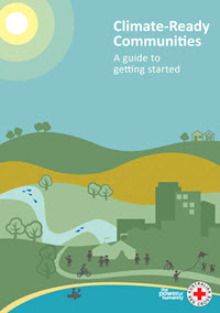
 Yes, the Red Cross provides a 26 page guide that you can print. The guide is for anyone wanting to support their community to prepare for and adapt to the impacts of climate change, whether they be individuals, a self-organised community group, local council or community service provider.
The guide was prepared within a South Australian context. While some of the information and resources relate to South Australia, the process is applicable more broadly. It has been developed through community consultation in the Yorke and Mid North and Eyre Peninsula regions of South Australia, and a comprehensive review of best practice for engaging with communities on climate change adaptation.
Climate-Ready Communities A guide to getting started
IS YOUR HOME IN A FLOOD PRONE AREA?
 The Victoria State Emergency Service has published floodmaps for all Victorian regional and metropolitan areas.Below are links to the floodmaps for Port Phillip, surrounding suburbs, and places that are particularly flood prone like Elwood, Balaclava, St Kilda and South Melbourne.
- Port Phillip
- Balaclava and St Kilda (Port Phillip)
- Elwood Local Flood Guide
- Balaclava and St Kilda Local Flood Guide.pdf
- South Melbourne Local Flood Guide.pdf
- Altona & Seaholme (Hobsons Bay)
- Bayside (Bayside)
- Glen Eira (Glen Eira)
- Melbourne (City of Melbourne)
CAN A CYCLONE IN QUEENSLAND CAUSE FLOODS IN ELWOOD?
In February 2011 Cyclone Yasi swept through Queensland causing massive floods and damage. However 2000 km away, in Elwood, on 4 February 2011, Yasi caused torrential rain and flooding in Elwood as well as other areas around Melbourne.
Here are some videos posted on YouTube of the effects of the floods at the time.
https://www.youtube.com/results?search_query=elwood+floods+2011
Port Phillip Councillor, Dick Gross, has made flooding in Elwood a key element of his Facebook postings. https://www.facebook.com/DickGrossCanalWard/
